|
The Sierra Nevada mountain range separates the Great Basin from the
Great Central Valley. This mountain range has uplifted twice in its
history; first as a result of the lifting of marine sediments and
after millions of years of erosion, again mostly as a granitic
mountain. These two uplift episodes were a result of plate
tectonics. The extinct Farallon Plate was subducted under the North
American plate as a result of eastward pressure by the Pacific
Plate. This force did two things it lifted the ocean basin to expose
the sedimentary rock to great heights (some estimate this height to
be greater than today’s mountains) and the magma produced by the
subduction created the granitic batholith that is today’s modern
Sierra Nevada range. The point of contact of magma with the
overlying rock resulted in transformation of the marine sedimentary
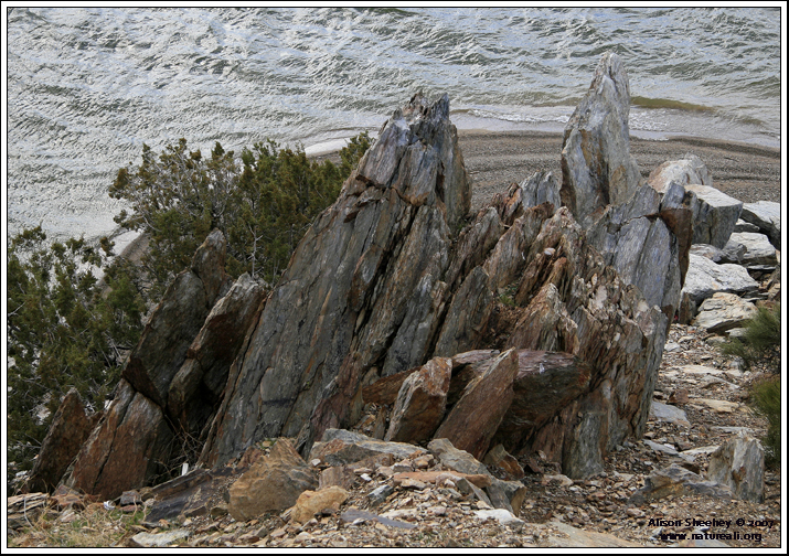
rock into metasedimentary rock that is referred to as roof pendant.
These roof pendants are the reddish fractured rock that is
occasionally encountered in travels around the Kern River Valley.
The modern Sierra is aged at 2 to 40 million years of age depending
on which geologist you ask. The Kern River
Basin is uplifting at a steady 5mm per year.
There are multiple plutons that make up the entire batholith which
were uplifted and exposed at different times throughout the entire
stretch of the Sierra Nevada. The South Fork Kern River at its
northern reaches is made up of intrusive (granite) and extrusive
(lava) material near the Golden Trout Volcanic field. It drops
rapidly from Inyo National Forest through granitic canyons into the
Domeland Wilderness of the Sequoia National Forest and Bureau of
Land Management. Although intrusive material makes up the bulk of
the rock throughout the entire reach of the river, there are also
noticeable areas of metasedimentary rock outcrops and limestone
dikes in the lower reaches. Above Fay Canyon in Bartolas Country
there are also five exposed outcrops of ancient volcanic basalt.
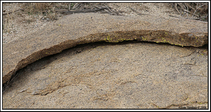
Granite is quite erosive and supplies the South Fork with a good
load of sediment. The construction of Isabella Reservoir in 1953 cut
off a significant portion of the sediment supply to the downstream
portion of the Kern River. This has resulted in an increased volume
of transportable materials deposited upstream of the reservoir due
to reduced flow along through the South Fork river channel,
increasing the potential for flooding throughout the South Fork Kern
riparian forest.
Seismic Potential
The Kern River Valley is bounded by several major earthquake faults.
The closest fault, Kern Canyon along the North Fork of the Kern
River to Engineers Point between the main and auxiliary dams, was
described until recently as seismically inactive. Research done by
scientists at Caltech have discovered it to be a vertical slip fault
that has moved more recently than previously thought.
There are several local
active faults capable of
producing earthquakes that exceed magnitude 6.5.
Large earthquakes jolt the area relatively infrequently but regional
fault zones have produced devastating earthquakes in the past. The
White Wolf fault which runs along the southeastern edge of the San
Joaquin Valley and is 60 miles to the west produced a magnitude 7.2
earthquake in 1952. This earthquake damaged Isabella Dam, then under
construction, causing completion to be delayed by several months.
The White Wolf fault along with the Garlock Fault just to the south
delineates the horst (uplifted area) that makes up the Tehachapi
Mountains. The White Wolf fault is the geological dividing line
between the Tehachapi’s and the Sierra Nevada. The Owens Valley
fault near Lone Pine east of Mt. Whitney separates the eastern
Sierra Nevada from the Great Basin range. In 1872, it produced a
large earthquake estimated at greater than 8.0 and actually lifted
the Sierra Nevada 16 feet in some places.
Two other major faults in the region that are capable of producing
massive seismic events have been relatively senescent for over 150
years, the San Andreas lies 100 miles to the west and southwest and
the Garlock fault lies 70 miles to the south. The last major
earthquake produced on the section of the San Andreas affecting our
regions was in 1857. The Fort Tejon earthquake was estimated to be
7+ on the Richter scale.
Liquefaction is possible along the South Fork Kern. Groundwater in
the South Fork Valley is relatively high which increases the risk
for unconsolidated soils to liquefy as a result of a major
earthquake. Groundwater is found at depths of 2 to 20 feet under the
lowland areas of the Kern River Preserve.
Soils
Quaternary alluvium is extensive in Kelso and South Fork Valleys.
The mostly sandy loam soil is a result of sedimentation from the
flowing river. The soils that form the alluvial basin and the upland
slopes are mostly from decomposed granite bedrock with limited
metamorphic rock.

About Audubon Kern River Preserve
The Kern River Preserve is managed by
Audubon California for the preservation of one of California’s
largest contiguous cottonwood-willow riparian forests and the
wildlife it supports.
Audubon Kern River Preserve supporters provide financial and volunteer support for Preserve outreach, education, wildlife habitat protection & stewardship.
|